-40%
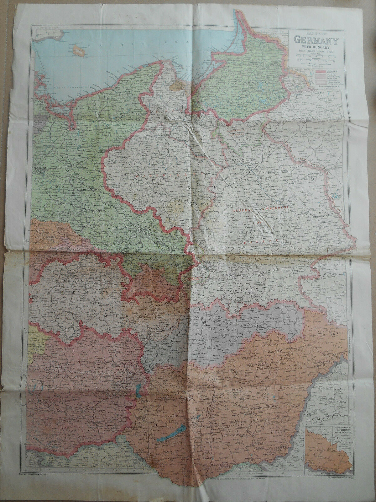
WW2 1940 British George Philip & Son Map of Eastern Germany and Hungary
$ 36.95
- Description
- Size Guide
Description
WW2 1940 British George Philip & Son Map of Eastern Germany and HungaryExcellent color-printed map of Eastern Germany and Hungary issued during the Second World War. Published in Great Britain by George Philip and Son Ltd., London (1940). Scale 1:1,500,000. Measures 31 x 22 in. (79 x 57 cm). A good, bright copy with some overall toning, wear and a few cuts along the fold line in the middle. Please see photos for additional descriptions. The map will be delivered flat and folded as it was folded by its original owner.
Payment
We prefer payment by
Paypal
. Payment is required to be made immediately.
Shipping
Shipping is limited to
USA, Canada, United Kingdom, Germany, France
, Austria, Belgium, Denmark, Finland, Iceland, Ireland, Italy,
Liechtenstein, Luxembourg,
Netherlands, Norway, Poland,
Portugal, Spain, Sweden,
Switzerland, and Vatican City
. We dispatch all our items within 1-3 working days of receiving payment. They are packed with care and shipped via USPS. If you desire to have your purchase insured, we are happy to assist you with it if you request it. We do not charge for packaging materials, handling and labor. For those, who live in NY, the variant of
free local pick up
is avaliable, but in this case we accept only cash. Please contact us before choose the free local pick up as a delivery option.
Shipping Discounts:
We will combine shipping for multiple items if all items can be shipped together in one package. Please contact us in advance if you would like to get the combined shipping.
Returns
We usually accept returns and offer money back within 14 or 30 days. However, we absolutely never accept returns for reasons such as "changed my mind", "found a better price" or "just didn't like it". Please return goods only for objective reasons and in the same condition as they were received. Also please note that buyer is responsible for the return shipping costs.


